No products in the cart.


THE ULTIMATE CORRIDOR MAPPING SYSTEM
The Ranger ULTRA is an airborne laser scanner with an impressive combination of weight, range, accuracy and pulse rate. It is equipped with a unique forward and rear looking FOV designed to minimize laser shadowing and provide geometry on complex vertical structures on a single pass. With its wide field of view of 100 degrees and an extremely fast pulse repetition rate of up to 1.8 MHz, the Ranger ULTRA is perfectly suited for high point density corridor mapping applications such as power line, railway track and pipeline inspection.
Phoenix offers several Ranger ULTRA camera accessories as well as UAV and manned aircraft attachment options. Please visit our booth or website to learn more about this amazing new addition to the Ranger series!
![]()
![]()

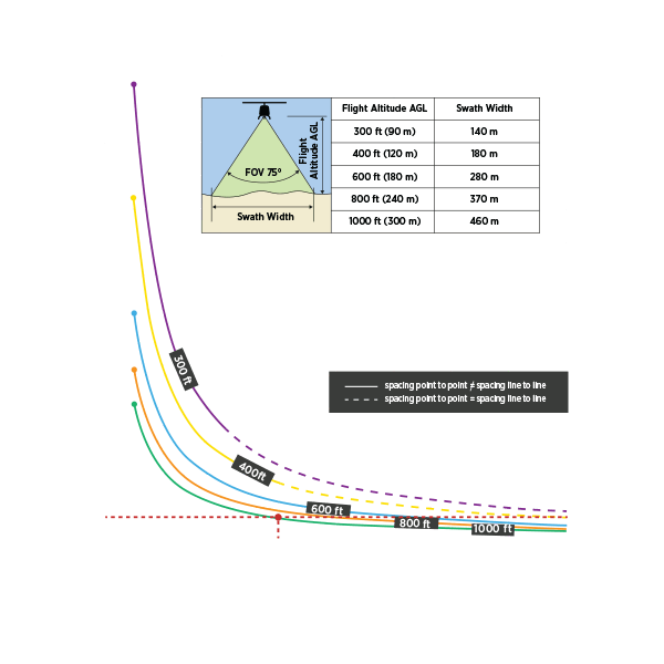
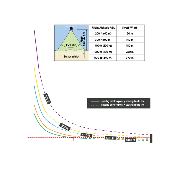
Point Density Speed & Altitude
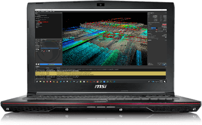

Phoenix Software Suite
Included with all Phoenix LiDAR Systems packages
Phoenix LiDAR Systems provides a proprietary complete software suite for streamlined acquisition, geo-referencing, data fusion, export and post-processing in the cloud.


